
Weekly revenue
Weekly downloads
Rating
Price
Screenshots



Subscribers only
Subscribe to see revenue estimates, ads, complaints and keywords.
Launch offer: 50% off until October 31, 2026
Revenue history
Available on Pro
Active ads
Available on Pro
Complaint themes
Available on Pro
About
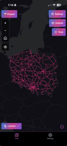
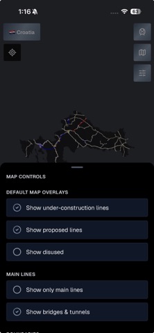
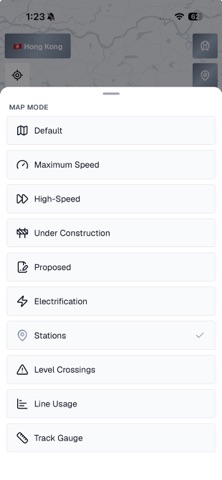
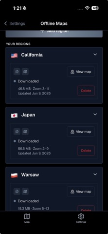
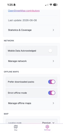
See how the rail network is built. RailsMaps maps railway, metro and tram lines in 1,150+ regions (countries, states, provinces, cities): max speeds, lines under construction, proposed routes, disused and abandoned lines, stations, level crossings, bridges and tunnels, electrification and track gauge. It's an infrastructure map, not a journey planner. Pick a region and you get every line, from national main lines to city trams, downloadable for offline use. One-time purchase. No subscription, no ads. INFRASTRUCTURE MAP MODES • Max speed: lines colored by permitted speed • Electrification: electrified lines by system and voltage (AC and DC) • Track gauge: standard, broad, narrow and mixed • Usage: main lines, branch lines, industrial, heritage and military • High-speed: dedicated high-speed lines and upgraded fast corridors • Stations and halts • Level crossings, classified by safety level • Under construction: lines and extensions being built • Proposed: planned and approved future lines • Historical: disused and abandoned railways Available map modes depend on the region and rail type. EVERY RAIL TYPE • Mainline railways, metro (subway / underground), tram, light rail, narrow gauge, monorail, funicular and miniature railways TAP FOR DETAILS • Tap any line or station for speed, gauge, electrification, usage and Wikipedia info WORKS OFFLINE • Download a region once, then use it with no connection • Offline packs are updated weekly • Detail scales with region size: city packs zoom in further than country packs, and you see the zoom range before you download • Strict offline mode: the app uses only your downloaded packs and makes no network requests • Wi-Fi-only downloads and per-region storage control MAKE IT YOURS • Built-in presets: Default and FreakMaps (infrastructure-style colors) • Custom presets: set rail line colors, widths and opacity • Save up to 20 presets, with separate colors for light and dark maps • Light, dark or auto basemap, plus an OpenStreetMap-style Carto look • Adjustable rail opacity, map labels on or off • Country and city boundary overlays • Compare two regions side by side • App theme: light, dark or system SEE WHERE YOU ARE (OPTIONAL) • Show your position on the rail network, in passive or active location mode • In active mode the map follows you along the line, handy on heritage railways and old routes BONUS: 2 WEEKS OF WEB EXPORT Buying the app includes a free 2-week map export pass for railsmaps.com and freakmaps.com. Style a map, clip it to a region and download it as a watermark-free PNG, right in your browser. One-time claim. COVERAGE • 1,150+ regions: countries, states, provinces and major cities • 13 interface languages Map data © OpenStreetMap contributors. Detail and completeness vary by region. Same data as railsmaps.com, the free web map, now on your phone.
Keywords
Available on Pro