
Monthly revenue
Monthly downloads
Rating
Price
Monthly revenue
Monthly downloads
Rating
Price
Subscribe to see revenue estimates, ads, complaints and keywords.
Launch offer: 50% off until October 31, 2026


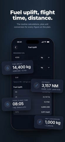
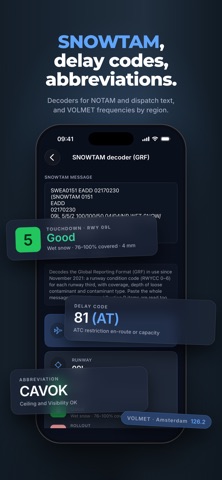
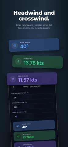
Preflight is a set of essential tools for pilots: weather decoding, duty limits, performance figures and references. RUNWAY AND AIRPORTS • Headwind and crosswind components for any runway and reported wind, including gusts. • 70,000+ airports with ICAO and IATA codes, elevation, coordinates, runway lengths, widths and surfaces. • Sunrise, sunset and twilight times in UTC. • Airport map. WEATHER • METAR and TAF, decoded line by line: wind, visibility, cloud, temperature and dew point, QNH, trend. • Flight category at a glance, with the raw report kept alongside. • VOLMET frequencies by region. DUTY LIMITS • Maximum daily FDP from the EASA FTL tables (ORO.FTL.205), by report time and number of sectors, including extended FDP. • In-flight rest planning for augmented crews: rest per pilot for 3 or 4 pilots, with equal or custom splits, against the UTC clock. CALCULATIONS • Fuel uplift in kg, lb, litres, US and imperial gallons, with adjustable fuel density. • Flight time across multiple legs. • Great-circle distance between airports. • Unit conversion for the figures on the plan. DECODERS AND REFERENCE • SNOWTAM decoder for the Global Reporting Format: runway condition codes per third, coverage, depth and contaminant. • IATA delay codes. • ICAO and airline abbreviations. Pin the tools you use most to the home screen and put them in the order you fly with. Not for operational use. Always consult official sources. Preflight is made by Cloud Valley B.V.
Not on the US charts right now.